The Great Canadian Adventure - Part I
As long as I live, I’ll hear waterfalls and birds and winds sing. I’ll acquaint myself with the glaciers and wild gardens, and get as near the heart of the world as I can. John Muir
The 2022 Great Canadian Adventure started with the newish truck and trailer. Gil had done the preliminary work in January and we just had to stock it up with all-weather clothing and plenty of non-perishable food since we really didn’t know what would be available en-route.


No troubles with the rig so we set out for many weeks on the road.

Bon Voyage
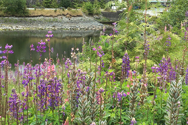
LET THE FLOWERS BEGIN
Silver Falls, Oregon
was a one-nighter, more rain hiking. In
retrospect, it was an introduction to the delight of the entire trip. We enjoyed wildflowers everywhere we went –
forest floor, open country, roadside, mountains, and prairies. We also got fascinated by the discovery of
trees as they changed throughout the trip.


Pacific Bleeding Heart

Western Hemlock with spectacular new growth

OLYMPIC NATIONAL PARK
When we booked
our trip six months out, we thought we would need a 72-hour Covid test to enter
Canada. We scheduled four days near Port
Angeles but were able to just enjoy our time there as the test was no longer a
requirement, if vaccinated.


We returned to Hurricane Ridge to hike as we didn’t have time last year. Still some snow on the ground, not surprising at a mile high. It was a little foggy coming back down to sea-level.


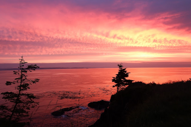
We also had time to return to the Sol Duc Valley and hike to the falls (since it was pouring last fall). It seems the entire time we spent in rain forest (the Pacific NW including Vancouver Island) we chased waterfalls.


This leftover tree trunk is hosting a myriad of forest plants including a maple tree
The US/Canadian
border is half way across the straight so all the paperwork is done before
boarding Black Ball Ferry.


Goodbye Olympic Park

We had a glitch
with our phones not switching over as they were supposed to and Gil spent a day
with Verizon resetting his so that our free roaming kicked in.
We went downtown to get our
National Park Passes for Canada, next door to Chinatown. As we were staying right on the harbor it was
easy access. We could actually see the
parliament buildings lit up at night from our site. We managed to figure out the ATM machines and
switched to Canadian money. We also
switched to liters for gas and at $2.22 CAD it was about $6.75/gal US (we would
pay considerably more later). The Canadian dollar was a friendly 80% of US.


The harbor barber


GOLDSTREAM PROVINCIAL PARK
Scheduling the
trip was a challenge – BC Provincial Parks are reservable exactly two months
prior to date needed. I was so nervous
about them not being available for us, I booked other locations as back up and
had to cancel as we got what we wanted.
We are rookies at camping but as anyone can see we weren’t interested in
wall-to-wall campgrounds with hotel-like amenities – we were after forest
settings.
Goldstream was heaven, each
campsite 100 meters from the next one.
Lovely hikes to falls.


Last leg to Goldstream Falls


Another variation on the banana slug, not sure how many I moved out of the middle of our various trails


Large dogwood flower 6-8”


Stonecrop

Columbia tiger lily (about the size of a quarter), scattered all along our walk at the Sooke
Along the roadways we were seeing lots of pretty (but invasive) Scotch broom and wild foxglove, and we were seeing them along this trail as well.

Scotch broom (or Scot's broom)


As we were leaving, this young Golden Eagle
swooped right over the truck and landed in a tree behind us.
Plant ID App
I picked up a coastal wildflower pamphlet and later an Alpine wildflower brochure but I had another trick up my sleeve. My friend Suzanne in Kauai is a forager and very knowledgeable about the Pacific Northwest having lived in Washington, N. Idaho, and British Columbia. She became my plant ID app for the trip. I sent her photos and she not only named them, but told me if they were edible! Invaluable later as we hit berry season. (And/but if I’ve gotten any wrong let me know.)
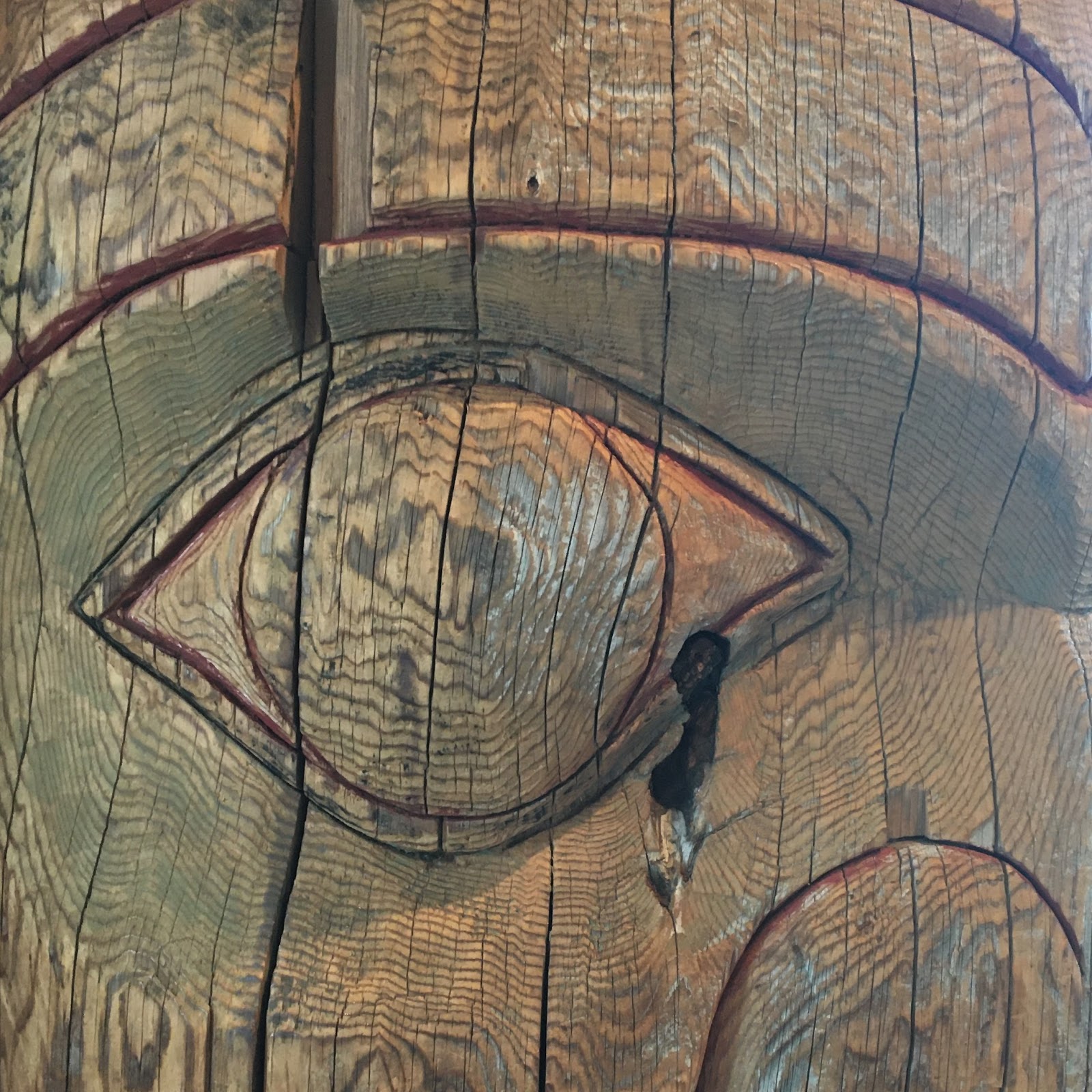
DUNCAN – CITY OF TOTEMS
On the road again, we headed north. Duncan is on Cowichan
Nation land; the city and indigenous tribes co-govern to honor each other’s
heritage. Over 40 totems grace the small
town, each with interpretive signs regarding the story being told and a bio of
the carvers. 2012 was the centennial the
effort commemorates (but has continued on).


Quench, offering Duncan’s famous pure water for passers-by, including dogs
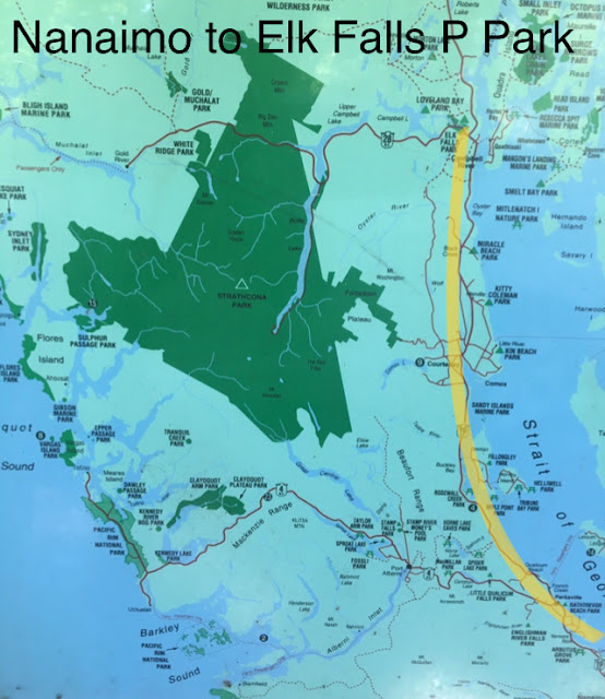
Nanaimo was to
be our hub to visit the west side of Vancouver Island and Pacific Rim National
Park. We stayed at Brannen Lake.

It was a long round-trip drive so we
started early. We stopped in at Port Alberni where I had lived in 1976,
outfitting a salmon boat in March and April and then fishing in May-June. A nostalgic village that has modernized
somewhat, like everywhere!

This is the Port Alberni pleasure-boat harbor, we didn’t go to the
fishing-boat harbor.

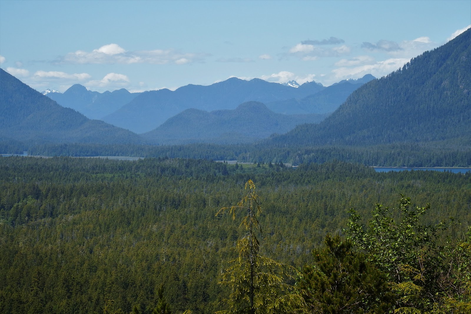
The drive to Tofino came highly
recommended as crossing the mountainous Island is quite beautiful, especially
along Sproat Lake, then the Kennedy River and Lake through the Mackenzie Range.


Taylor River Rest Stop (popular for its clear green water)


We made it to the outer edge of Vancouver Island, the National Park hugging the coastline and outlets. We picnicked at the (other) famous Long Beach. It is pretty amazing, known for surfing and or watching the incredible Pacific winter waves.


A really long beach - 16km or about 10 miles
After a short hike above Tofino, we did drive down and skirt the village, a little too crowded for us but a popular destination. Major construction along the route home was pretty dramatic.
Tofino overlook

Surprise along our hike


Major project to widen and straighten 1.5 km of highway along the bluffs.
Back to the east side, we
traveled along Georgia Straight between Vancouver Island and the mainland. Even with the trailer, we were able to make stops on the way: Qualicum Beach, Miracle Beach, Courtney (for groceries),
and Campbell River.

Qualicum Beach

Path to Miracle Beach

The snowcaps of the mainland across the way, made this a particularly lovely spot

Quinsam Campground (are they looking familiar now?), so beautiful


This woodland visitor was hilarious waving his leafy branch wands. (You had to be there).

Elk Falls bridge

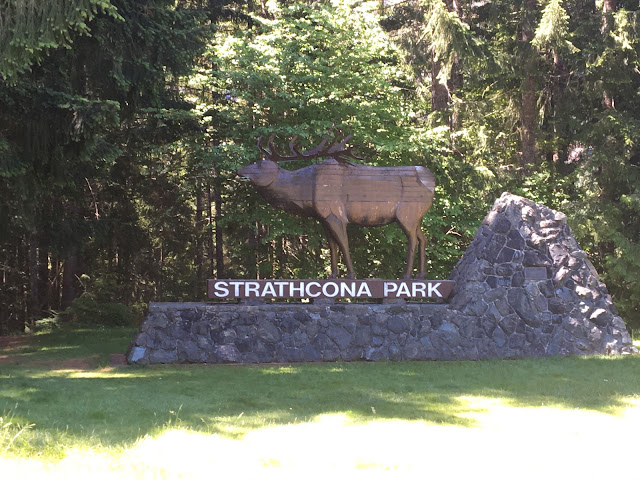

Travelling back and forth across the island, we were appreciating the differences in terrain and various make up of coastal forests: Western redcedar, Douglas fir, Western hemlock, numerous maples, and spruces.


Quite a climb to Lady Falls


Before leaving
Quinsam, we did a little morning hike.


We learned that
few Vancouver Island residents go north past Campbell River. It began to feel very remote even in the
small towns. But our next stop was to be
very exciting.


At our picnic spot along the way, Miner’s lettuce, (not very tasty I was told) but so cute!

Site #92, right between the two trailheads from the park. Just a quick walk from our site to the beach
or (much longer) up the mountain.

Bauza Cove looking toward the Gulf and islands beyond


We visited the very small boardwalk-village.

There were tours being advertised for seeing the Orcas or a Grizzly adventure that was very pricey.

I couldn’t wait to take a boat out among the gulf islands – I wasn’t here just for the highway scenery no matter how stunning. Eagle 53 was waiting for us . . .


Leaving at 7am, we were rewarded for our decision by this
bald eagle just as we pulled out of the harbor

Everything it should have been and more, we were on the boat nine hours!
Our destination was Glendale Estuary off Knight Inlet, a glacial fiord actually located on the Canadian mainland. Growing there is the super nutritious Lyngby’s Sedge the grizzly bears love to eat.


Near that we saw an exposed causeway that shows up at low tide (the tides vary enormously out here because of the islands' push/pull on the waters).

Sadly, another staple of their diet is the mussels that grow on the rocks – the bears end up starving to death in their later years because their teeth have been ground down by the shells.

Closer to the estuary, we got to see another mom and cub, a little more unusual. This mom had not sent this cub away and it was now five years old, pretty rare. Not sure if she wanted extra protection or what.


Cub eating the sedge. It was such a privilege to watch them knowing humans were not interfering in their lives.


Before we left, mom walked over and climbed up to eat
salmon-berries off the bushes.
We came around
the point and docked for lunch. Food is
kept track of very carefully so that, even though the bears can see the boats,
they don’t associate them with anything either inviting or threatening.

We did see gulls, eagles, deer, and other critters: this little seal popped up to check us out.

Lunch was set up in the middle of the floating dock. Our guide said there was always a “lunch
bear" around. Funny thing, our lunch bear was
taking a nap on the beach while we ate.
Finished, we boarded the double decker with a shallow draft (on left) to go deeper into the estuary. Later, we made a slow loop back to the bigger boat for the return trip.


I got some final shots that made my day all over again!


A little harbor seal napping on a submerged log.
It wasn’t over,
on the way home we saw a humpback whale breach and dive and a group of
sea-lions frolicking!


Salmonberry cereal (loved eating bear food)
We walked around the village and peeked at the other campground; ugh – we made the right choice. Ours was quite what it needed to be and so glad we were in the forest!

Poor Gil – a planted canoe!
The end of the lupines we had so enjoyed so far (the seed
pods so velvety)

Obviously logging is a major industry on Vancouver Island
On to Port
Hardy. No one comes here except
fishermen, loggers, and people taking the ferry.

Geared to the ferry travelers, the campground was very modern – good 5G wi-fi and very clean. We had a very pleasant walk bird watching with binoculars.


Late evening, again
CANADIAN INSIDE PASSAGE

5:24am, no services at the BC Ferry terminal, we brought our hot
drinks and muffins, ready for the long day ahead.


There were outside decks and covered seating where we spotted humpback whales spouting and the occasional otter. (The short video below of white-sided dolphins may or may not play with your browser, hope so!)

The passage was very narrow at
times and we saw endless waterfalls as the snow melt made its way down the
mountains.


When we weren't lounging in comfortable seats, staring at the scenery, we played cards and ate at the quite nice cafeteria.

Sunset approached but it was still light til after ten pm.
Finally, an
hour late, we arrived at Prince Rupert (located on Kaien Island) at about 1am. Gil had spoken to the manager of the Walmart the day before and we parked in their lot overnight. We
woke up to see that we were just above Prince Rupert Sound.

Our entire agenda for this town was to go to the Museum of Northern BC. It did not disappoint.


Extremely important to two of the
indigenous nations, the lower Skeena was occupied by the Tsimshian and the
upper by the Gitxsan providing each with fish and hunting grounds.

The colonizers later used it as well for steamboat shipping until the railway was built and bumped them out. Roads and rails often follow rivers; we would be near trains for much of the Canadian mainland.


At South Hazelton we were the only campers. The setting was a field of ox-eye daisies surrounded by poplar trees.


We could see this mountain from the camp. It has two names, one of them the Indian name, but asking a number of locals what they call it we got the following: our mountain, my mountain, or the mountain.


We were on our way to Kispiox to
see some of the less publicized original totems. The area is where the Kispiox river joins the
Skeena. A local came and told us about
the tragedy of his lost culture and the attempts to keep alive their family
stories (totems).


We had our picnic on the Kispiox river, just ahead of it joining the Skeena.

On to 'Ksan, it was a shame that it was not open for ceremony as they have worked hard to build an informative representation of their people – the people of the Skeena.


I was most impressed by the powerful location; the mountains and the massive river that threw those logs into a pile in its travels.

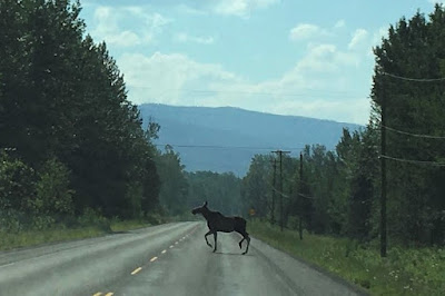
On the way back we saw this pretty female moose cross the road. Surprisingly, it would be the only moose of the trip for us.


Comments
Post a Comment