The Great Canadian Adventure - Part 3
As long as I live,
I’ll hear waterfalls and birds and winds sing. I’ll acquaint myself with the
glaciers and wild gardens, and get as near the heart of the world as I
can. John Muir
I only booked one night at the next provincial park. Had I
been sure of a reservation at Mount Robson, we may have spent more days there. From there we would cross into Alberta and be
on mountain time.
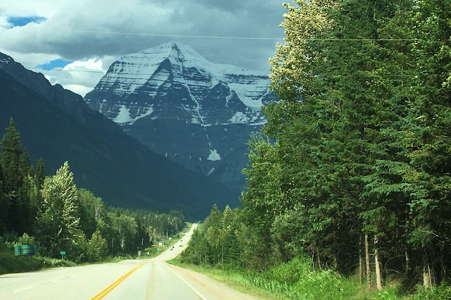
Mt. Robson is the highest peak in the Canadian Rockies (12,972’) and said to be visible only twelve days a year. Guess what we saw on arrival?

We went
straight to the visitor center but they were closed 6pm

The Indian name is roughly translated: Mountain of the Spiral Road. We were impressed with the layout of the campground when we heard it. Site #102

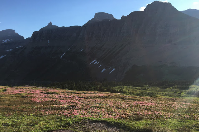
Blue columbine, now we are in the Rockies
Leaving next morning at 7am, we got to see it as most people do, glorious either way with the carpet of
wildflowers leading to the forest. We had caught back up with the Fraser River
that we would follow to the heart of the mountains.

Cloud Top Mountain
JASPER
As I mentioned last post, I booked
this campground in January because Alberta rolls out reservations for each
park, for the entire season, on a specific date. Jasper National Park opened January 31 at
5:00am Hawaii time and with 6605 people ahead of me, I waited an anxious hour
for my turn. I got one site for 3 days
and another for 2 more days, ie, we had to move the trailer mid-visit. I was ecstatic.

Reservation
We were very lucky to book Wabasso campground as the others in Jasper (Whistlers
and Wapiti) had suffered even more from the beetle kill and had had to
clear-cut the trees for safety; they are barren! Our site included a
fire permit and all the wood we could burn.

Lono got us to the Rockies in fine form

Park woodpile
NOTE: throughout the trip there were warnings to respectfully not move wood because of beetle infestation; most parks either provided or sold local wood for campfires, as long as there was not a fire ban.
I expected over-crowding and a zoo-like tourist atmosphere because of the
popularity of Jasper. I couldn’t have
been more wrong, happily. This turned
out to be my favorite five days of the trip. It was everything I needed: the
gorgeous Rockies and big animals, plus, plus, plus.
The Athabasca River valley is extraordinary and mind boggling as the
powerful gray glacial water runs north to the Arctic Ocean. The valley is studded with many lakes and
diverse landscapes. Short distances from
Wabasso were both the hike to the Edith Cavell glaciers and the magnificent
Athabasca Falls. An hour away we enjoyed
mineral baths. Jasper village had ample
parking, a decently stocked little grocer, and the most amazing laundromat we’d
ever seen! Go figure.
We went to Athabasca Falls fairly late the first day. What a wonder. I’m not sure what was most impressive, the
volume/velocity of the water, the water chiseled rocks, or that we had access
around both sides and directly over the water.


You could actually walk down a previous water pathway here to experience the chiseled rocks.

By chance, that first evening, we discovered we were more likely to catch
sight of big animals at dusk and that became our habit either before or after
dinner.

Beautiful cow elk (7:30pm)
SKYTRAM
We took the tram up for an overview, whew! At the top, we hiked further up until the
trail was buried in snow; had our picnic on the rocks as we soaked in the
panorama. Tiny, tiny wildflowers
everywhere in the alpine tundra – macro/micro moments.

Pleasant little
village of Jasper below in Athabasca Valley.


EDITH CAVELL MOUNTAIN
We drove the narrow steep road to
the Edith Cavell trailhead. At this
roadside glimpse of the mountain, another family told us they come visit every
year from Calgary. They were so excited
for us to see more, “just wait, it’s even more beautiful!”

Mt. Edith Cavell


I didn't realize that Indian
paintbrush were any color other than orange-red. These salmon ones opened my eyes and I would be surprised again and again.
We climbed the dirt trail up to the
lookout then scrambled all the way down the rocks to get to the meltwater lake
below. It was sobering to actually watch
the hanging glacier melting.

Angel Glacier at
upper right, one wing extends to the left (another to the right)


Cavell Glacier and Pond
Once we took in the grand scope of
things, smaller parts of the whole landscape caught our attention. I absolutely love rocks and in scrutinizing
them, this hoary marmot came into view.


It is heartachingly fragile.
Scrambling through the rocks, we
would be surprised by random ice. There
were warnings against being too close to the wall as sometimes chunks of ice
the size of houses came down.


Gil spotted (with binoculars), a ball of snowy white ice ready to drop from the very top of Angel Glacier. Once I got the shot, we realized it looked like a Polar Bear (our first).

Since glaciers are actually rivers of ice that flow, it won’t take much for that giant snowball to tip forward and come crashing down!

Gil on the path back
Menziesia along the way (must be very hardy)


Later we realized this rapid river below the winding Cavell Road is actually the glacial runoff we’d been watching; it will join the great Athabasca River at the bottom of the mountain. The experience of Jasper was proving to be very profound.
MALIGNE LAKE
We drove out to Maligne Lake (65km
away) and it was one of those twilight-zone experiences as the road hugged
strange up-thrust walls of rocks and passed Medicine Lake surrounded by dead
trees. Once we got to Maligne, the lake
itself was quite beautiful with the snowclad mountains poking up.

Alberta is known for placing bright red
double-Adirondack chairs at very scenic spots, they even appear on maps
We did a hike along the lake then looped through the forest back to the parking lot. We were getting used to starting hikes at 6pm.

Lake Maligne

We expected to see moose here (from all the warning signs) but really had to keep an eye on our footing instead of looking around.

Heartleaf arnica

The strange
mountains as we headed back
It was 8pm as we neared the junction back to Jasper when we saw these bull elk one after another and tried to photo them through the window. I’d forgotten their real name is wapiti as elk is the German word for moose.


A half hour later we spotted this female with her two youngsters, all eating flowers. We were familiar with the behavior of the mom instructing her little one to hide in the brush for safety while she eats, but inevitably, they pop up to see what’s going on. The yearling is quite content to be bedded in clover.


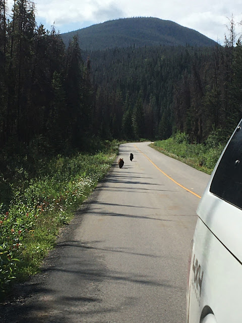
On down the road, a baby black bear made an appearance but just as quickly ducked back into the trees. So many sightings, so much natural wonder to absorb, we managed to sleep well after a quick dinner.
Time for a hygiene day, we gathered
the laundry and our swim gear. We
intended to visit the hot springs after the chore. On the way into town, Gil stopped the truck
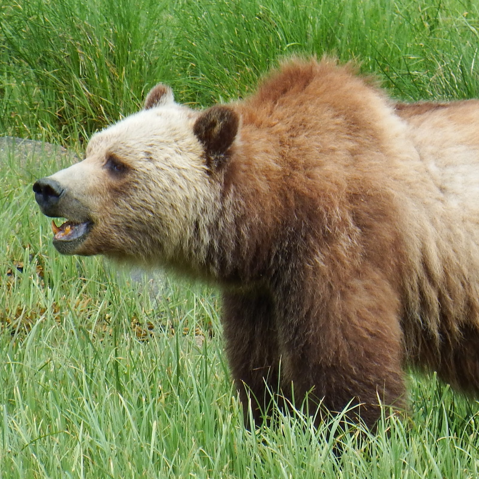
and said “bears!” As I struggled to
unplug my phone, they ran right under my passenger window. By the time I got out, they were up the
road. I knew the second one to run by
was a young grizzly but we eventually figured out he was chasing a young black bear. We’ll never know if they were playing or it
was territorial.

Below street level reflecting town

A little chai and cappuccino during the game
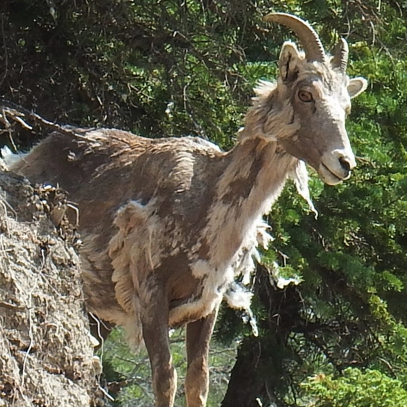
We also needed a soak, so off to Miette Hot Springs. On the way, we saw a few cars stopped along the road which means, grab the camera! There was a group of Big-horn sheep up the rocks: females with their kids.

Two moms, 3-4
yearlings and two little ones altogether (I think) made their way up the side. Super shaggy, some haven't lost their winter coat entirely.

As we pulled away, we saw that they were coming over the top. They like to keep their backs to the mountain.

Outer grounds at
Miette, lovely.

Multi pools, multi temps, mountains all around . . . We talked with a nice family, high school girls learning all kinds of new things in the mountains.
On the way home, Gil turned toward
Maligne road hoping for some twilight friends.
We weren’t disappointed when this grizzly, not a cub this time, crossed
in front of us. Clean hair, fingernails,
and sheets plus lots of critters – great sleep again.

ICEFIELDS PARKWAY
Between Jasper NP and Lake Louise (in Banff NP) the road is called
Icefields Parkway, running 233km (145 miles).
We decided to drive part of it without the trailer, so glad we did.

We stopped at Sunwapta Falls, had our picnic, and did the Lower Falls trail several km that featured multiple drops along the path, as well as glimpses of glacial mountains behind, and a colorful forest floor.


Wild rose country (Alberta)


Tangle Falls on the
east side of the highway was pretty remarkable

Just before reaching the Icefields Center (ahead on left) Athabasca mountain loomed before us, the glacier of that name curving down at right. The road followed the runoff.

We would recognize these purple cones for the rest of the trip.
We decided to hike to the toe of
Athabasca Glacier across the road and try to sort the fast-disappearing natural
wonder from the commercial disregard for it. Amazingly we only needed our down
vests over t-shirts at 5pm.


Too soon, it was time to leave Jasper. A little nostalgic, we hitched up and headed out early. We came across this fella we now call the good-bye bear. Wandering from one side of the road to the other, I can’t say we were in any hurry and he wasn’t either.
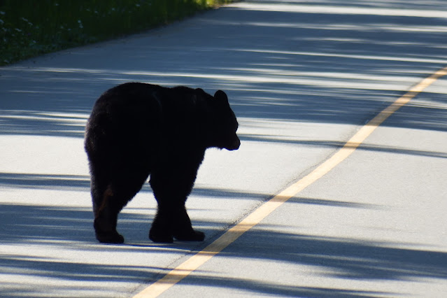
6:30am

6:34am

6:35am

6:38am Grass is always greener?


Southern half of Icefields Parkway
BANFF NATIONAL PARK
On our drive down, we planned to visit the many scenic turnouts. Funny thing about Banff National Park: in spite of the march of mountain peaks, road signage is poor to non-existent. So, Weeping Wall and Bridal Veil falls, for instance, appeared on the map but were not marked on the road. Even in a practical sense, turnouts (to let faster vehicles pass) were not indicated ahead. That coupled with the very steep downhill grade and high winds made the drive uncomfortable. We would have to return later to see anything specifically.

Weeping Wall? No idea.

This spot had a nice long turnout so we could take a breather and let other cars pass.
Our campground was nice. It was situated between the Bow River and the rail tracks that formed the park boundary. I really never minded, hearing the train whistle in the night – not so close it was jarring, it made me smile and fall back to sleep.
We were staying in Lake Louise campground but never actually saw the lake. Everything I had heard about overcrowding and traffic were magnified. Every poster and piece of literature suggests booking shuttles on-line, getting schedules of talks, etc. online – however there was no service to access the info.
I asked a ranger if we could go very early and catch sunrise at Lake Moraine (without the shuttle) and she said the parking lot was full by 4:30am. We were finally allowed on the road at 8:30pm after the crowds subsided. Once we got away from the hub-bub, it is absolutely gorgeous. Such a shame it is so poorly managed.


Its famous aqua
color still evident in the evening light.
Johnston Canyon
We tried our luck visiting one of
the features of the park during morning hours, Johnston Canyon. On the way, we saw a number of cars stopped
both ways and sure enough, a black bear with two cubs decided to cross the
road. The first cub kept up but the
second got disoriented in the wildflowers on the side – it was so corny
adorable when he stood up on hind legs and looked around for mom. Spotted, he quickly ran to catch up. With the traffic, we didn’t manage to photograph
them, but it is an indelible memory.
Johnston is a gorgeous gorge with a boardwalk along the rock edge, but it
was like a nose to shoulder line at Disneyland for 5km. We skipped one part because the line out a separate
little bridge was so backed up for selfies it just wasn’t worth it. It would be so very special minus the
jostling crowd. Did I mention the guy
pushing his way through with a Rottweiler “service” dog?


Just a foot above the trail, another little group of twin-flowers being totally indifferent to the myriad pounding feet.
Moving on, we found an isolated
turnout to have our picnic lunch just below the Castle Mountains. What a
relief.

Castle Mountains


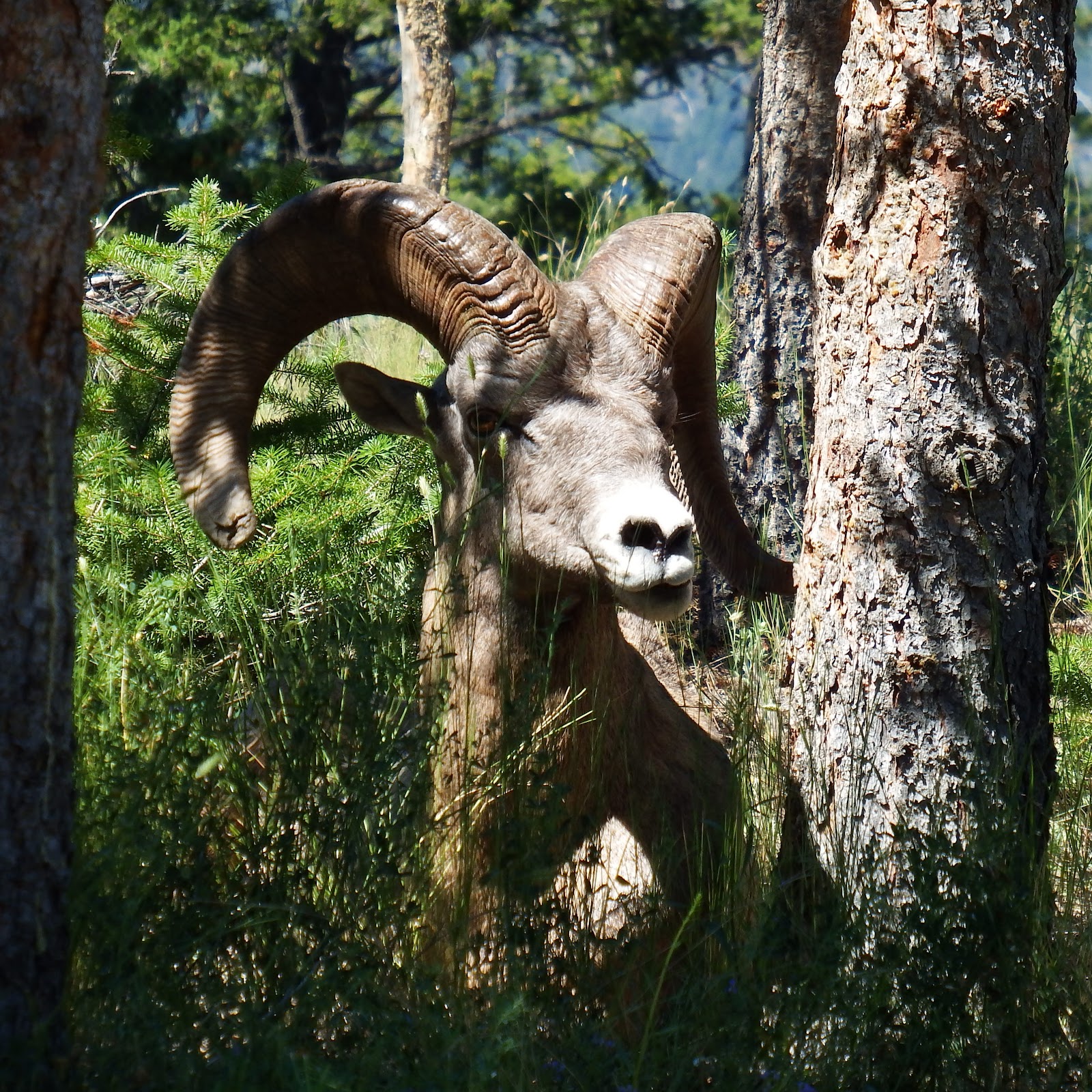
Female big horn
sheep licking minerals from the ground!
We had heard we might see this.
The natural minerals provide nutrition for muscle and bone. (Four here and two more near shade up hill.)
PEYTO LAKE, BOW & CROWFOOT GLACIERS
We drove north again on Icefields
Parkway to visit Peyto (pee-toe) Lake.
Nice hike up to the viewpoint.


We knew glacial runoff was a silvery gray from seeing it in Switzerland, Alaska and the Athabasca Valley. So where did the Caribbean blue water come from in the rivers and lakes?

Another little climb gave us a view at Bow Glacier (with its moraine tracks visible). At front, all the Engelmann white spruce sporting their purple cones. And a view of the delta mentioned above.

The hike back to the car, among tall
trees, ravens, and also some ankle-high gems along the way (unknown to me).


Driving back toward Lake Louise, we had more views of Bow Glacier and Lake.


Crow Foot Glacier - easy to see how it got its moniker.
The crest of these
mountains is the dividing line between Alberta and British Columbia and I
believe the Continental Divide as well.
Yoho National Park is just west of Lake Louise and we did want to visit. Takakkaw Falls, Emerald Lake, and Wapta Falls
were on our list for Yoho.
The drive to Takakkaw Falls was up a steep incline with hairpin turns; one
that required us backing up to negotiate.
The falls were fantastic. We
found a nice bench and I took this video while Gil went to grab our picnic from
the truck.
We tried to find Wapta Falls, however it was only in fine print that there was no access to it if traveling southbound. Confused, we had to leave the park, drive another 17 miles to find a turnaround and then access it from the northbound Hwy. WTF?

Finally, on the right path.

Wapta falls
Next stop was Emerald Lake which was gorgeous and made the nutty day worthwhile.


The water in these mountains is nothing short of luscious. In addition to the lunch we packed in the morning, I had also packed a happy hour knowing we were likely to be out in the lingering light.

7pm and miles
from home . . .
Finally on our way out, we stopped
at the natural bridge. It is geologically
one of the most interesting sights we were introduced to.

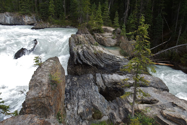
It may resemble
wood, but is volcanic stone with the water rushing under the center

Because the national park and the highway system through it are shared, they have fenced the highway for miles and miles and built very nice wildlife corridors that cross it. It allows animal migration and reduces car/animal road hazard. When an animal reaches the fence, it may follow it to one or another of these bridges.

Leaving the park, our next stop would be Redstreak Campground in Kootenay National Park just minutes out of Radium Hot Springs. Even though we’d be in BC again for a few days, this little corner of the province stays on mountain time.
We climbed our way up the mountain to
the campground. On the hairpin turn to reach it, these fellows were lounging in the noon
shade.


FERNIE, BC
We were excited and anxious about
this next stop to visit friends from Princeville. Les warned us about his road, both figuring
out where the unmarked turn was, and negotiating the soft shouldered narrows of
it. He was actually on the road waving
us down and then he drove us in, in his car, to show Gil where to hug the bank,
etc. It went perfectly and we had a nice
parking spot with electric and water.
The forty some acres are as stunning as foretold.

Les had built the fabulous house himself over thirty plus years and
together they have landscaped it gorgeously, something different in bloom each
month.

Les and Stella sitting on some newly made larch log benches, yet to be installed

One corner of the garden with its own aqueduct system
We had not met Stella on Kauai, but felt like old friends in a few
hours. She is truly gifted with plants:
microscopically, landscape design, and wild identification. We trekked to the
creek, where along the way we identified the wildflowers and dodged occasional
bear poop.

Makani, their pup

A stubborn little
buttercup by the river

Back to the house followed by a nice dinner in the
cute ski town of Fernie.

Not so quick
goodbyes - looking forward to seeing these guys on island.
Four years ago, I started thinking
about getting to Glacier NP in Montana, not particularly easy from Hawaii. I even asked my sister-in-law if she was
interested in her and I going in their camper. It was too big an endeavor for
her to leave her animals. A lot happened
since then; this year it became the end destination that had started our
massive Canadian loop north. Weather was
a major consideration since Glacier has a very short window for travelling the
Going to the Sun Road through the middle. This year it didn’t even open until
July 13 and we got there the 27th.
Let me back up. Waterton Lakes is
the park on the Canadian side just north of US Glacier NP, and together they
are one of the few International Peace Parks in the world.

Again, worried about being able to book a Park site within our tight reservation dates, we were at a private one. It turned out we had the loveliest site in the campground. It backed into willows, buttercups and goldenrod, the trickle of Crooked Creek out the window, and our firepit and table were very private.

Lovely evening,
the mosquito coils we bought at Radium worked well.


We had checked out Bison Paddock as
the best spot for stargazing; open plains next to the mountains. Entirely fenced, we spotted the group of
bison that live there.


There are five obvious adults and a calf here, but I think there is another adult and calf hidden in the cluster.

It took me quite a
while to figure out this is wild Bergamot
We were not aware, before going, that there had been a devastating fire in
2017. The park would prove to be shockingly stark. These bison have only been
returned to the paddock this year and the two new calves are a very welcome
addition to the remaining herd. One bull
that refused to be evacuated to Saskatchewan with the others, survived near the
pond!
The town of Waterton sits on one of
the three lakes, and the historic hotel called The Prince of Wales is a
landmark sitting on its own little peninsula.
Built as a fancy stop to entice early railway passengers, it was
ambitiously named in hopes the prince at the time would stay there. He did not, but the name remains. The splendid view from the lobby and
restaurant sweeps right up the beautiful lake.


The town at right
Of course, we took the boat that
goes up the lake. It crosses over into the US and then returns. It used to stop on the US side, let people
off to wander around and catch the next one back, but due to US understaffing
we were not allowed to land.


We drove out to Cameron Lake, lunch in town and to Red Rock Canyon for our late afternoon hike. Both then and now this scenery is emotional to view – witnessing the aftermath of the fire brought me to tears. Logic tells me fire is natural, giving light to the understory. My mind knows it but the loss of our cabin in Rocky still hurts. This is five years after their Kenow fire – the trees are still standing and that understory is waist high at most. Kudos to this park for restoring the infrastructure that was demolished. Over the course of the day, I learned to appreciate what is there.

Akamina Parkway


There was a nice mix of roadside flowers, oblivious to everything around them except their nature to bloom.

The ever-present oxeye daisy, goldenrod in foreground

Common Gaillardia

The famous
Alberta prickly wild rose, or Arctic rose

A pink version of Indian paintbrush

Alpine fleabane

Cameron Lake was inviting but we did not take the time to rent one of the boats on offer.

We returned to Waterton village for a
rare lunch out before heading out Red Rock Parkway to the Canyon. Another austere drive, with Blakiston Creek
alongside.

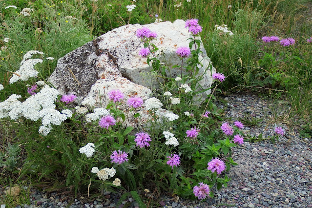
Wild bergamot and yarrow
We spotted a black bear with two cubs below us near the water. She worked, they played, and sometimes kept up.

She turned over rocks for treats underneath

Log rolling
At the parking lot it looked like
rain but we charged on along the stream to the falls through what had once been
forest.


Marveled at the colored stone


Blakiston falls

Both red and green coloring in the limestone is from minerals infused during the period it was a seabed!
On the way back we looked for mom
and cubs again. They were near a large turnout so we were able to watch them
for some time. Past 5:30pm, they
hoped for few more bites before bed. So
sweet.

Clearly turning the rock

Following her nose (keen smell)

Couple little knuckleheads playing in the
flowers

That paw was made for this job
Sadly, we were leaving Canada, for the year, but really looked forward to
Glacier NP.

Parks map
The pink line goes from Fernie to
Waterton and the excursions there, then across the border into St. Mary, East
Entrance. The dotted line is the road
over the pass, out the west entrance and around the outer perimeter of the park
back to St. Mary.
Glacier is all about the Going to
the Sun Road. The border crossing
was quick and we got settled early in the day.
Unfortunately, another one of my 5am in January bookings, it was a pull-thru
on the left-hand side of the road; a mistake that won’t happen again. In order to leave room for our pull-out
dining room, the entry door was right next to a stump. Gil had to saw it off; very tight space.
That done, we enjoyed the Visitor Center and got great advice from the
ranger there for the next day.

Due to considerable road work being done at night (avalanche two weeks prior) the acclaimed road was closed from 10pm to 6am. Our campground was inside the park, located on that road, so we did not need a reservation to drive it. The glitch was limited parking at the top. We were advised to leave at 6am and drive to Logan Pass in order to find parking, as the cars streaming up from the other end would take a little longer to get there!
BLACKFEET DANCE PERFORMANCE
Luckily for us, there is a performance only twice during the summer and we
were able to go that evening to watch members of the Blackfeet tribe dance in
their fabulous hand-beaded regalia. This was the only program we had seen even
though most parks have outside seating arenas for ranger programs, I think
COVID concerns had pre-empted any scheduling. I do know First Nations and
Native American tribes were extremely careful about exposure for their people
everywhere we went.

The setting was incredible with light still hitting the mountain above the trees at 8pm.

After this young woman danced (she had a 9-day old baby in the audience), we were asked to guess what her beaded cape weighed, no one came close – 85 pounds! And her slippers and several other pieces were not painted, but heavily beaded as well. Of course, she had done the work herself.

The MC combined
Indian lore, humble values, and humor.
He liked to say “this is an old Indian trick a white man taught
me.” He’s the local basketball coach and
a couple of the drummers and dancers play b-ball. In addition to school and practice, they make
their own outfits and compete in regional and national dance competitions.
Where we had seen puffin beaks on ancient coastal
wraps, her jingle dress sported little tinkly cones made from snuff lids!
The culturally significant prairie grouse dance
We had a light dinner at 9pm and early to bed for our morning race up to
the Logan Pass parking lot.
Minutes past our campground, the
aptly named Rising Sun area. Quite
beautiful in the early light, I would like to have come back another morning, to just sit and watch these mountains light up.


The plan worked; we ate our cereal on the tailgate after we got parked at
the pass. At the top I spotted what I
thought were bear grass flowers but they are actually feathery seeds on spent western
pasqueflowers. I love
them.

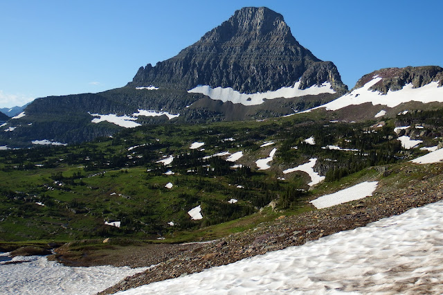
Of all the trails, we chose to head for Hidden Lake. Wow! There was dirt trail, gravel trail, boardwalk, tromping over icy snow, sometimes slush, all the while surrounded with gorgeous mountains, huge glades with wildflowers and running rivulets, up, up, up. We didn’t get all the way to the lake because the trail was closed due to deep snow. I couldn’t have asked for more.
The scale of the area is very
difficult to express, even with the visuals. As we climbed, there were valleys
below us where tall trees looked like ants.
It was hard to comprehend as every moment was new and beyond dreams.

Glacier lilies - we had seen a few in Olympic National Park, but this is fields of them. What a privilege.
I'm still trying to figure out what this gorgeous pink carpet is (neither fireweed nor the fuchsia Indian paintbrush unique to the area)

Fuchsia Indian
paintbrush

Layered landscape

Camouflage, big
horn sheep just waking

The look of contentment on this guy’s face as he takes his morning whiz

The one on left hasn’t yet risen his heavy head; the horn rests on the ground to sleep
More layers
looking the other direction

Marmot running below us between the layers

Our first mountain goat, what a specimen; he still looks sleepy too (I’m assuming a male with that big scar on his face)
Once we knew they were there, we scanned the rocky cliffs for others. Ten
minutes later another, lit from the sun; and then ten minutes more (and higher)
one more. Wow!


Not to overlook little critters at eye level, Columbian ground squirrel
Anyone that climbs up knows that the views coming down are entirely different.

Turning point


Would love his perspective


We had stopped to get a closer look
at these plants with the bluish flowers (plus the valley view on the other
side). We truly had not expected the
flora to be such a big part of our adventure.

Turned out to be sagebrush mariposa lily

The little bright purple guys are called self-heal

We made our way down to the river below, following it to Lake McDonald

Lake McDonald

A very nice picnic spot as we eased back into the hordes of people
After Apgar Visitor Center
at the west entrance, we cruised the perimeter of the park to return to St.
Mary. We scouted a couple roads to see
the most suitable route for bringing the trailer south. I’m sorry we didn’t get into Two Medicine
Lake (parking lot full) but we had had a really satisfying day. Little did we
know it was our only day there.
We had moved to Sleeping Wolf on the Blackfeet reservation near Browning, it was quite a lovely spot, with the mountains now visible across fields of wild yarrow and cornflower. With our emergency resolved, we were strangely at peace.


Next morning, we spent time in town at the Museum of the Plains Indian.

We talked to local artists and visited the trading post. The merchandise was for the local craftsmen
and women – many hanks of beads, good books, herbs, clothing, etc. My kind of shopping (visit their website:
theblackfeettradingpost.com)


My whole suitcase smelled like sweetgrass when I got home (eventually)
I knew when planning the trip that
once we left Glacier, I’d be like a stable horse heading for home. The yellow line on the previous Parks Map, we
headed for Big Fork, MT on Flathead Lake.
It should have been nice but the Elmo fire left the area less than
ideal. It was too hot to hike and we
didn’t like our campground which was in the process of becoming long-term
rental only. Expensive and nothing to
offer other than a list of restaurants in town; the woods I had seen on the satellite view were fenced off.

Woods Bay looked like a nice little community on the lake

Toys like this would be a lot of fun (Elmo fire across the lake)
Other than boating, there wasn’t much appeal. Until we went cherry
picking, that is. They had a bumper crop
and since pickers didn’t show up, we were sent into the orchard to pick our
own. We ended up collecting 4 lbs. besides
what I ate as I picked. It stirred childhood
memories of going with my grandmother in Loveland, Colorado. I couldn’t stop smiling. And, it was cool in the shade. It would be a nice treat for days to come.


We drove the length of Flathead Lake on leaving, followed Flathead River until it turned west and joined the Clark Fork that led us into Idaho. We avoided the smoky area enough to not need masks but kept our eye on the air quality index. It was a very nice drive.

Leaving the smoke behind

Clark Fork, Idaho
We wanted to see both Sand Point and Coeur d’Alene so our campground was on the Priest River in between. It was situated in a bowl formed by magnificent cedar trees. It is unfortunate the owners didn’t appear and no one told us we had access to a beach across the road on the river. Neighboring campers told us about it (too late). It is doubtful we will get back that way but I would recommend it to others, especially if they have kayaks.


The beach, with toys, kayak launch, picnic pavilion, etc. we didn’t get to use. Ce’st la vie.
Sandpoint sits on the shore of Lake Pend Oreille at the foot of a skiing
mountain. Seeking residents that work
remotely they have invested in internet availability. They claim to be high
tech/ high rec, with all the outdoor activities of the area. We spent a relaxing day at City Beach and
took a nature boat tour, spotting eagles, quite refreshing.


Juvenile Bald Eagle, adult plumage incomplete (pic of the day)
New Princeville neighbors, directly
behind us, have a home in Coeur d’Alene and happened to be there as we were
passing through. They invited us to park
out front and spend the night. They gave
us the grand tour of downtown, neighborhoods, the college campus, marina(s) and
we went to dinner at a very good Italian restaurant. It was lovely to get to know them.

Ground level view
from trailer – the house backs into the woods

Didn’t expect to see a moose downtown

We would soon meet Denny and Darlene in a campground near Bend, OR so we stopped at a truck stop for one night. Much to our surprise, it was actually a very nice grassy RV park with utilities, clean showers, etc. En route we had to don our N95 masks for the first time due to smoke in Washington. The campground was full of killdeer playing in the dusk light; the moon pretty bright.


D&D were already at Indian Ford campground when we got there. Great to catch up with them over picnics at camp, we kayaked at Suttle Lake and walked to the head of Metolius Spring.

Last campground of the year, in Ponderosa pines this time.


Metolius Spring with Mt. Hood in background
We all headed back to Ashland. We had a family birthday dinner in town, third time out in three months! I believe if you pull a kitchen, use it.

Gil and I had a mountain of unloading and sorting to do. I was able to erase our site schedule and recent menus now that we were back at base. I got a very small image framed that I bought in Fernie of a loon. There is so very little wall space, he is perfect.


Dandy and the local deer. Denny is storing the vehicles until the next adventure. Aloha Oregon.


Wow oh wow!!! All the critters, all the water, flowers too! Beautiful, thanks for sharing this true labor of love!
ReplyDelete