The Great Canadian Adventure - Part 2
As long as I live, I’ll hear waterfalls and birds and winds sing. I’ll acquaint myself with the glaciers and wild gardens, and get as near the heart of the world as I can. John Muir
HOLOHOLO BRITISH COLUMBIA
Our previous
truck was lovingly called Lucille (like BB King’s guitar) as all the owners
were blues fans. Our new truck is
seriously masculine and since we were going holoholo (wandering land or sea),
it seemed fitting to have a Hawaiian god lead the way. Lono is the powerful god of harvest, of
winter rain, and of the season of peace, and married to Laka (of the forest).
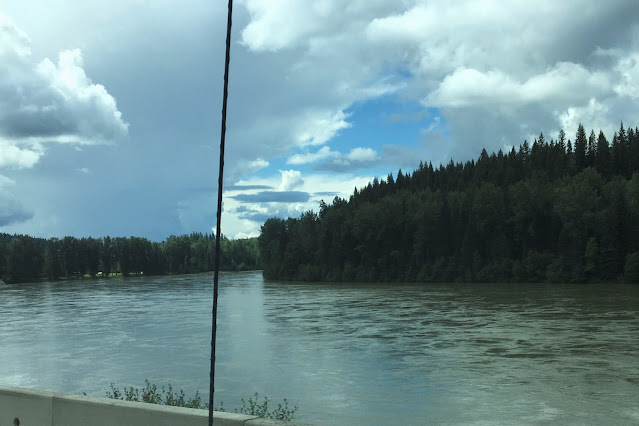
We continued the beautiful drive to Smithers for fuel, then had to split
the distance to Prince George.
Our next stop
was my biggest booking mistake. The
campground at Babine Lake was, by far, the worst experience we had. Forty km of gravel haul road from Burns Lake
to the shiftiest place of all. It was
very pretty but the bugs were killer (a week plus of Benadryl to recover from
tiny wicked black fly bites to face and neck).
A deceivingly nice view from the trailer; we
could not step outside without our face nets on! And, no one
mentioned the electric was shut off from 10pm to 9am, it just stopped. We were
OK off grid but not warned?

The best part of this stop was seeing three separate black bears on our way out. A little cub ran across the road, later this adult meandered his way across. Just as we got near town another very small cub started across but I’m quite sure his mom grunted hard because he spun back around out of sight.

SOUTH TO WELLS GRAY PROVINCIAL PARK
The typical
route is to drive from Prince George due east on Yellowhead Highway 16, but
Wells Gray was an exciting destination from my reading, so we detoured
south through the Cariboo Mountains and looped back up afterward.

We stopped overnight at Prince George, a sizable town (Costco gas). Fraser river encircles the city.
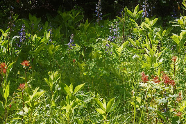
We stayed at Mama Yeh campground about 15 minutes out. Charming people, Edward Yeh came out and welcomed us, called the district to see if there was a fire ban or not so we could have a fire, and sent us a thankyou text when we left! The spacious campsite had aspen, Indian paintbrush, and red columbines.

Our next one-nighter at Lac La Hache was very charming, in the woods. We didn’t even unhitch, just enjoyed the lake across the street and boogied on next morning.

We had met people on the ferry that were travel guides taking a busload of nature folks to Haida Gwaii (maybe future bucket list) and they were also very familiar with Wells Gray. They sent a message with us for the “hot dog guy” at Spahats Falls. We delivered the message and ended up with new friends.
Originally from Belgium, they are certified chocolatiers with a processing lab in their home (that we enjoyed seeing) and she is a locally renowned baker as well. What a blast with them. They are due here on Kauai in October. They live right on the North Thompson River but during tourist season, he sells good wurst and Belgian waffles and ice cream at a kiosk. They travel the rest of the year, ie, the winter.

North Thompson River from the back yard of Johan and Maryse in Clearwater, BC.

Spahats Falls
We loved Wells Gray, enjoyed
every minute of it. Four days in one
place was longer than usual, but there were so many waterfalls to see! It was light hiking to most and picnics all
along the corridor between sights.


We drove the whole corridor up to
Clearwater Lake expecting a lot of activity and maybe canoe trips – nothing
much happening there at all – perhaps not fully functioning after Covid.

I did like the community fire-ring


Bailey’s Chute, an eight-meter plunge, was a lesson in water power. James Bailey, an engineer who worked on bridging the violent Clearwater River, drowned just downstream of this rapid (one of more than a dozen major stretches of whitewater).


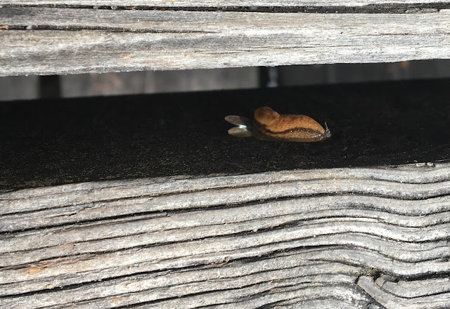
By shifting focus, literally looking behind us, all the drama of the water was balanced by life that is smaller or slower, and no less appreciated.

Our campground was very pleasant, well into the Park but on private property.

I happily used the
laundry room early mornings to catch us up.


Gil rescued this pretty guy from the firepit (but he was already gone)
Between hikes and waterfalls, the Visitor Center in Clearwater provided much needed secure wi-fi so I could do some banking! It took a few days for the credit card companies to do the conversions from Canadian to US dollars; I kept up best I could so the statements would not be such a nightmare later. The visitor center was a really pleasant building with good park-info provided by energetic young guides that spend all their free time hiking.


Not much of a shopper, I wore this bracelet the rest of the trip to honor my new bear friends.
I tried to send a picture a day to Darlene in Oregon (not always possible with spotty service). Suffering from drought, she was amazed by so much water. Murtle Lake is quite large (fed by a glacier in the Cariboo Mountains). Murtle River then flows toward the corridor where it joins the Clearwater River coming down from that lake. They all pour into the North Thompson. Yes, it is a LOT of water; more than just snow melt, the glaciers are melting.

Murtle River coming right at our picnic spot (just before the bend it took), a little unnerving.

Path alongside
As the Murtle passes under this
bridge just before it dives down, it is called the Mushbowl – it proceeds on to
Dawson Falls before reaching the famous falls at Helmcken.


Mushbowl from the bridge

Dawson falls
Helmcken Falls, with nearly a 500-foot drop, is what inspired the preservation of the area that became Wells Gray Provisional Park.

So much water also created a nice
mosquito environment so were glad we had our head-nets. We suggested to our “hot dog” friend, Johan,
to sell them as more than half the people we passed on trails asked where to
get them!

We overheard one of the guides say if you only had one day at Wells Gray, hike to Moul Falls. On our last day we did. It was about 6km round trip and went from wide road, to forest, to dense wet forest.


We reached the rush of the river
as it made the plummet over the side, then a warning sign that going to the
bottom was dangerous. People coming up
said it was wet, steep, and slippery after the stairs ran out, but worth it. We put on our nets and went down. It was wet and steep, muddy and buggy, and
worth it.


Hungry when we got back, we aired out the truck and had our picnic. Lono in the poplars at Moul Falls trailhead.

Nostalgic to leave this Park, we headed out to reconnect with the Yellowhead Highway. We were told this route north had pipeline construction going on. It did, but parallel to the road so there was not much delay. While the railroads bumped out the steamships in bygone days, the pipeline will replace oil being transported by rail now.


To be continued


Your story and your pictures are outstanding! And so much water, wow....absolutely beautiful. Thanks for sharing!
ReplyDelete