NORTHBOUND TWO: RETURN

Return roads unknown,
adventure of the heart,
deeply connected
We followed the Tanana River leaving Fairbanks, turning back toward Canada. Our path south meant
going through Tok again. We stayed at the same campground and did laundry and
caught up with wi-fi needs. We had ten days to get to Prince Rupert for a
scheduled ferry. We made fewer stops along the Destruction Bay heaves as we
crossed back into the Yukon.
YUKON
Welcoming committee at the border

The Kluane mountains from the washboard road

We blew past (sort of) our previous stop and went off-grid for the night at Congdon Creek in Kluane National Park. (I'll always be amused by the bilingual signs in Canada.)

While we couldn’t bring wood across the border, the park provided plenty for campfires.


A chilly after-dinner walk at the lake

On the road again, I most wanted to return to the impressive cultural center at the base of the Kluane mountains.

As we were leaving, we saw a poster advertising a campfire talk that night at Kathleen Lake. A fellow came up to tell us he was giving the talk. He also said they were bringing one of the canoes to the lake.
We had gained a day so, what the heck, we backtracked 20km and spent the night at Kathleen Lake. The talk was great (see Ch 10 for the rest of the adventure).

Note here that the motif used by the Champagne-Aishihik First Nation is based on embroidered art. We saw this throughout the Yukon. The interactions we had with indigenous folks were some of the most rewarding of the trip.
Another fantastic campground in the forest. 
We had bypassed Whitehorse, the capital of Yukon Territory, on the way up. Now we had three days to explore.
We booked outside of town thinking it would be a big city. In fact, it is a charming town comfortably spread along the famous Yukon River. Large enough for provisions but easy to get around. (Real Canadian and Sav-On grocers are both good sources and Whitehorse had both.) Population is about 45K, a comfortable size.
Our third territorial park in the Yukon, so nice.


How to keep track of days. Whitehorse would replace Fairbanks (Mon-Tues) and then a rewrite of the following week's schedule.

How to manage supplies; possible menus went up after shopping. Then we ticked them off when used up.

We drove east to Miles Canyon, between town and our campground. It was originally called Kwanlin, "water flowing through a narrow canyon." It was too late in the day to hike the extensive trails along here.
The Yukon was a major transport avenue long before both the insatiable trappers and the gold rush. Today it is enjoyed for sport, especially when the rapids run in this narrowest section. Downriver, the town has built controls for hydro-power and tamed the flow.


We also visited several art galleries, including one cooperative that had great glass pieces. The artist suggested we go visit some glass sculptures they had done. Incredible. The park is right on the river, near the hub of town.
The Three Bears


A really interesting stop was the Yukon Beringia Center, featuring videos, exhibits and literally tons of information on the ice-age land bridge.

Like a lot of people, we mistakenly thought the land-bridge was a narrow passageway, when in fact, it was hundreds of miles wide.

Not only humans passed over the bridge, but many animals – all much larger versions than their modern descendants.
The Yukon panhandle boasts one of the main discovery sites that revealed bones of the huge animals from 20,000 thousand years ago, (blue arrow on map above).

We now had five days to get to Prince Rupert and planned a night in Watson Lake again before leaving the Yukon.
These young Poplars changed color first, summer on its way out.

Our pullovers for lunch were amazing. We may have soaked our bodies at the spa but daily we soaked our souls admiring the beauty of the natural world.

A stop we had missed going North was Rancheria Falls. Not a dramatic falls, but the surprising boardwalk stretches through forest for 1/3 mile each way.


BRITISH COLUMBIA
A bog fire had been burning for months at Boya Provincial Park on our way
up, but it was contained. It was a shame because Boya Lake is supposedly quite
beautiful, with many islands – great for canoeing and kayaking.
Now, on our return, the fire had jumped the highway and was being seriously addressed by Canadian Roads Dept.
Google maps showed Hwy 37 closed
and was routing us hundreds of miles out of our way. A savvy ranger at the
Watson Lake visitor centre said, “just go – your chances are good to get
through the fire zone with an escort.”
She was right. While the convoy was slow going, we had no complaint. We only had a 45-minute wait for our turn at this sad spot.

What looks like sun rays, is actually smoke rising from the burning bog, creating the black clouds.

Back at Kinaskan Provincial Park, we caught another lovely sunset on the lake after a very long day.

Nearing Meziaden Provincial Park, we hoped to stay for the night. We were surprised to find the park too full (Labor Day weekend). We continued on to Kitwanga where the Cassiar Hwy 37 ends at Yellowhead Hwy 16.

We wanted Kitwanga River campground, but I inadvertently put in “Kitwanga Lake.” We ended up on a single-lane dirt road for miles, hoping it would loop back into the highway since there was no way to turn around. Finally it did.
Kitwancool Lake (the correct name), we never would have seen it if I hadn’t goofed. It was lovely but we were happy to finally find our actual campground.

We shared the campground with the seasonal mushroom-hunters, each having their secret sites. Foraging is a big money-maker most years. We saw stands with signs that read “we buy mushrooms.” They collect them and export them, but this year wasn’t producing as much as expected.
Yellowhead Highway 16, from the Hazeltons to Prince Rupert, is a beautiful east-west drive we remembered from the previous year (in reverse).


Much of it is along the Skeena River. The Skeena was a major transport at one time by canoe, then steam boat, then rail, and eventually the road alongside.
Note the rail line between road and river. While the trains are still running, a pipeline from the interior is replacing some of the rail dependency.


We needed to get to the Prince Rupert ferry terminal by 8pm. The port-town is on Kaien Island.

HAIDA GWAII: THE EDGE OF THE WORLD
I have to say adding Haida Gwaii to our itinerary was very exciting. The
large group of islands off the coast (well north of Vancouver Island), is
very remote, even for Canadians.
In the late 1800s it was dubbed the Queen Charlotte Islands (for a logging cargo ship). In 2022 it returned to its original name and the culture of the original Haida people is prevalent. In the map below, all of the lavender colored areas are protected either as Parks, Heritage Sites, Conservancies, or Ecological Reserves. The yellow highlighting is us.

Graham Island, pictured, is separated from the archipelago to the South by Skidegate Channel. The South is even more remote with primarily seaplane or boat access.
Crossing the Hecate Strait overnight, we arrived at 5am towing our
trailer. Still dark, we stopped in the parking lot of the CO-OP store, and
napped until the manager knocked on our door. He welcomed us warmly, then chatted
us up for a good half hour as he loved camping himself. Now daylight, we drove
toward the campground.
Gorgeous drive, the rare sunny morning soon gave way to overcast skies.

We had no real idea of what to expect, but were very happy with Misty Meadows inside Naikoon Provincial Park, our off-grid hub for four days. We parked, unhitched, and travelled North taking advantage of dry skies.
Port Clements and Masset are ordinary enough communities with small homes, a few shops and cafes.
Cutesy charm


South of Port Clements the pavement gave way to gravel; so glad we didn’t camp here.
We later met other travelers that had continued on that dirt road to
Rennell Sound on the coast. They mentioned the 28% grade down and back up!
As we got closer to Masset, it got wetter. Bowhead whale mural (through the rain drops).

We ran across the street for lunch and got some good tips from a local about the community of Old Masset, up ahead. It turned out to be one of the highlights of the entire trip. (See Ch 10)
To complete the day, we drove along the top edge of Naikoon Park (and the island) on Tow Hill Rd.


Tow Hill, looking right 
The closer we got, the road became a slurry. We were unable to enjoy Agate Beach or collect the famed (shoe-sized) mussels at North beach, but going through the dense rainforest was mystical.

We were knackered after overnight on the ferry and a full, full day of exploring.
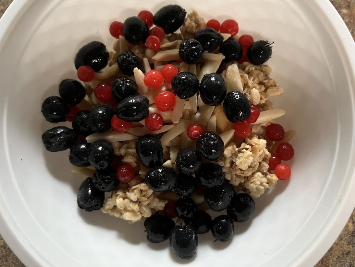
We did enjoy our camp! The entire park was fruiting salal berries and highbush cranberries. The next few mornings our cereal was teeming, and I made salal chili (based on my black-cherry chili recipe).
Salal berries 
Highbush cranberries 
We spent another day exploring Skidegate and Daajing Giids, formerly Queen Charlotte City. The drive was like no other, (and it’s not like we haven’t driven coastlines). The pictures simply do not convey the feeling that you know you are in a special place.


Balance Rock is pretty cool (zoom to see person to right of it for scale)

The cultural center was fantastic and while we couldn’t take pictures inside, the location is pretty spectacular. I don’t often catch a bald eagle with my phone!

We saw dozens of little Sitka Deer on the island, but this one was just outside a nice exhibit at the centre.

The view beyond the deer at beach level 
Meanwhile, back at camp, we checked out Naikoon on foot. See arrow at our site, trails went through forest and up and over sand dunes, down to the beach at right.

Oddly, used to no services when this remote, we got signal at the top of the sand dunes. All kinds of texts popped up.


It was fun to venture out along the beach at such a low tide. The rocks, normally submerged, were covered in barnacles.

I gracelessly walked over the round boulders to the end of the spit; looking back at Gil still on the beach.

The trail back to camp

How to fill the day when the ferry leaves at 10pm? Late afternoon we found a nice pull-out to hang, watch the twilight settle in, and have our leftover chili.


Prince Rupert
Back in Prince Rupert, we had one whole day before the next ferry. We had
scheduled it so we could revisit the cultural museum set in a longhouse. Off
the ferry at 5am, after a quick nap, we spent the day at the museum and still
had time for a hike.
Museum of Northern BC
A miniature totem carved by a local man we met on the street in Old Masset, Ron Russ.

Detail: Impeccable carving and inlay

It turns out, both Ron Russ and his son Marcel, have many pieces in the museum and their artwork is also available online.
It was easy to get overwhelmed by the many fabulous pieces we saw. We were happy to have time for a local hike to Butze Rapids through old growth forest.
Gil loaned me a spare hat, a bit big!

It was a charming hike just outside of the PR bustle.

VANCOUVER ISLAND
We boarded the ferry in the early dark again with a 16-hour ferry ride
ahead. Nostalgic that our trip was ending soon, we made the most of it! (see
Ch 3)
Once on Vancouver Island, we had three camps before crossing back into
the US: Miracle Beach, Qualicum, and Goldstream.
Miracle Beach camp

Our site was walking distance through the woods to the beach. Looking across the Strait of Georgia to the mountains on the mainland.

At Qualicum, our camp was right on the Little Q River and should have been teeming with salmon. Easy to see there was not enough water for them this year.


The town of Qualicum Beach was interesting with its fishing dock, birds, etc., but the community itself impressed us with two very different property acquisitions.
One was buying an old growth forest when a historic family estate was being sold off. Stepping from the bustling little town, into the 50 acre Heritage Forest, was like stepping into silence. The massive trees absorbed everything.
A living 800 year old Douglas Fir (187' high).

The other unusual Qualicum feature was the old school building, bought by a group of artists. It houses a gallery as well as a variety of working studios.

We talked to at least five different artists as they worked – producing everything from small drawings to large paintings, mixed media, printing, even yarn work. The photographer wasn’t in (the person that rallied the others to acquire the school).
Further down the road, we visited Rathtrevor Beach Provincial Park.

Again, we caught a super low tide. I was fascinated by the seaweeds that remained as the water retreated; each attached to its own rock.


Goldstream Provincial Park is less than an hour from the BC capitol Victoria. In planning, we thought we might go up to Butchart Gardens – but once we got there, we just stayed in the forest.

We hiked down to Goldstream Falls, 200+ stairs each way through incredible rainforest. It was great as Gil was able to do it, too, with a pain free knee.


Aloha Canada!


Comments
Post a Comment